 用中文读这个网页 |
  Chronology table about Senkaku
【Chenese Government leaves Diaoyu Island for 22 years】
The original of this article(reprinted) was written by a Chinese lady who is working in a Chinese company as a executive officer in Guangzhou, China.
She said, “Japanese right wings shamelessly say that Chinese government, in December 1970, suddenly began to claim that Diaoyu(钓鱼) island was our territory, though China had said nothing about the island until then!”
She continued, “Okay. All we have to do for dashing their delusion is only to find Diaoyu this name on 50's or 60's chinese maps!! However saddly .... ” Please look at the facts!
-
★Japan-China Relations: Current Situation of Senkaku Islands - Produced by the MOFA of Japans
introductory notes:
| Island name | Islands name | |
|---|---|---|
| Japan | 魚釣島(鱼钓岛,Uotsuri) | 尖閣諸島(尖阁群岛,Senkaku) |
| China | 钓鱼岛(Diaoyu) | none? |
#Q&A on the Senkaku Islands by Japanese Government
+++ China(PRC) was established in October, 1949. +++
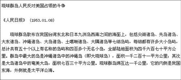
Renmin Ribao(1953.01.08) said “Senkaku(尖阁诸岛)” is a part of Okinawa Islands(琉球群岛):
 →
org
→
org
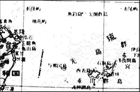
【1953 Yaguangyu map(亚光与地学社)】 puts only Taiwan as China. It doesn't include Senkaku.
【1958 World Map(世界地图集)】“尖阁群岛(Senkaku Islands)” are drawn as Japanese territory on this map.
“魚釣島” is the biggest island among Senkaku Islands. It is not “钓鱼島”.
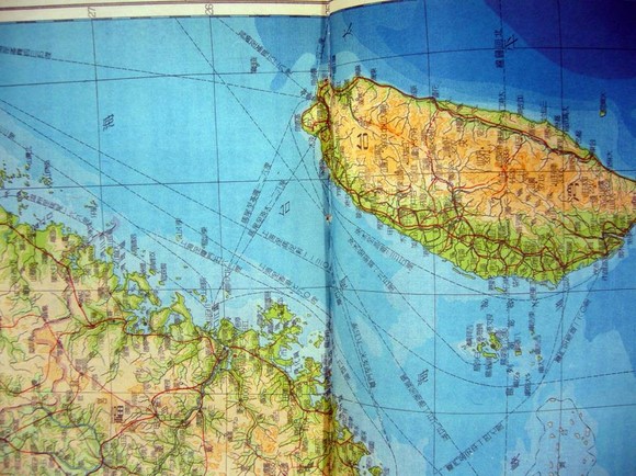
【1958 Chinese Goverment Official Maps - Taiwan part】 doesn't include Senkaku Islands.
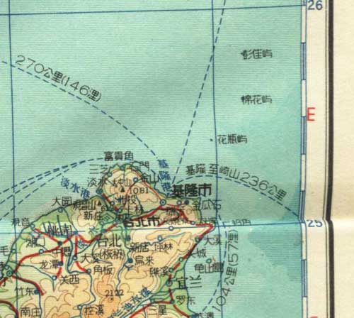
【1960 World Map】 * Chinese name = 钓鱼岛/Japanese name=魚钓岛
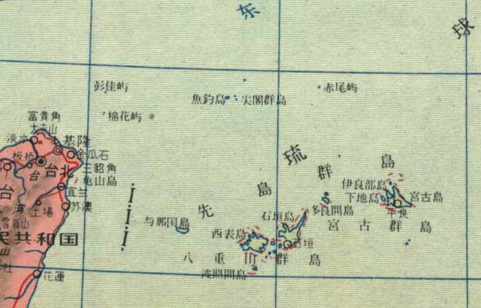
【1967 Chinese Goverment Official Maps - Taiwan part】
This map is also same as 1958's map. It doesn't include Senkaku Islands.
However ....1972,
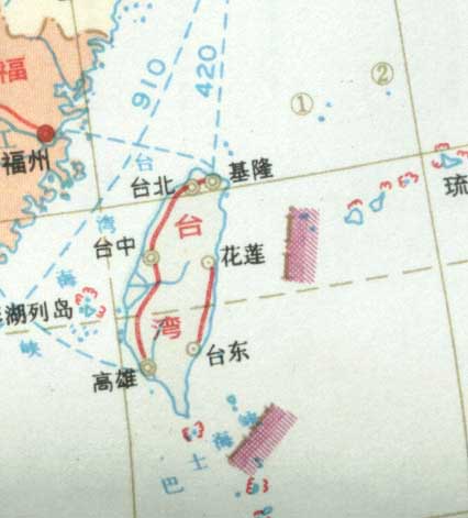
Senkaku Islands was begun to put as Chinese territory with ①② marks.
(The reason why ①② marks were used is because China could not make it to replacing to the chinese name for new version maps.)
After this version, all of the maps published in China put “钓鱼岛” instead of ①,“赤尾屿” instead of ②.
【1972 China geology map(中国地质图)】
The China map and Chinese government still can claim “钓鱼岛” is our territory?
>>See also
1:Diaoyu(Senkaku) is our territory? (Maps)
2:Renmin Ribao(1953.1.8): “Senkaku is included among Okinawa islands.”
3:Zhou Enlai(1951.8.15): “These islands never have been separated from Japan even by any treaties in the past.”
*:Chronology tabel, Q&A